Most visitors reach the Sahara on a there-and-back trip from Marrakech or Fes. Linking Zagora and the Draa Valley with Merzouga instead turns the journey into a loop, and the road between them is one of the emptiest and most atmospheric in southern Morocco.
It runs along the southern flank of the Jbel Saghro and through the eastern Anti-Atlas: wide stony plains, black volcanic-looking ridges, dry riverbeds and small oases with earthen ksour. Traffic is light, and the towns along the way, Nkob, Tazzarine, Alnif and Rissani, see far fewer visitors than the main tourist routes. This is also the road that brings travellers closest to Oumjrane.
Key facts
- Distance
- Roughly 280–300 km on paved roads, depending on the start point.
- Driving time
- Around 5 to 6 hours without long stops.
- Main stops
- Nkob, Tazzarine, Alnif and Rissani.
- Landscape
- Stony hamada, Anti-Atlas ridges, palm oases and kasbah villages.
- Services
- Fuel and cafés in the main towns; long empty stretches in between.
- Nearby
- Oumjrane lies in the Anti-Atlas south of Alnif.
Distance, driving time and road conditions
The drive is roughly 280–300 km and takes around five to six hours behind the wheel. From Zagora, the road heads north up the Draa Valley before turning east through Nkob, then continues through Tazzarine and Alnif to Rissani, from where Merzouga is a short final run south.
The road is paved throughout, but some sections are narrow, and you will meet occasional potholes, sand drifting across the tarmac, livestock and slow vehicles. Fill up with fuel in the larger towns, carry water and snacks, and avoid driving after dark. Mobile signal is good in towns and patchy in between.
Nkob: the village of kasbahs
Not far from the turn-off from the Draa Valley, Nkob sits on a hillside above its palm grove and is known for the large number of earthen kasbahs in and around the village, several of them restored as guesthouses. It is a pleasant place for a first stop and a walk through the old lanes, and a quieter base than Zagora for exploring the southern side of the Jbel Saghro.
Tazzarine and the rock engravings
Further east, Tazzarine is a small market town on the edge of a wide valley. The surrounding area is known for prehistoric rock engravings depicting animals such as elephants, giraffes and antelopes, a reminder that this was once a far greener landscape. The sites are unsigned and spread out, so ask locally for a guide if you want to see them, and never touch or chalk the carvings.
Alnif: Morocco's fossil capital
Alnif is surrounded by Palaeozoic rocks rich in fossils, especially trilobites, and fossil workshops and shops line the main road. It is worth stopping to see how the specimens are prepared, but buy thoughtfully: quality varies, and some pieces are restored or reconstructed. Alnif's weekly souk is also a lively, local affair.
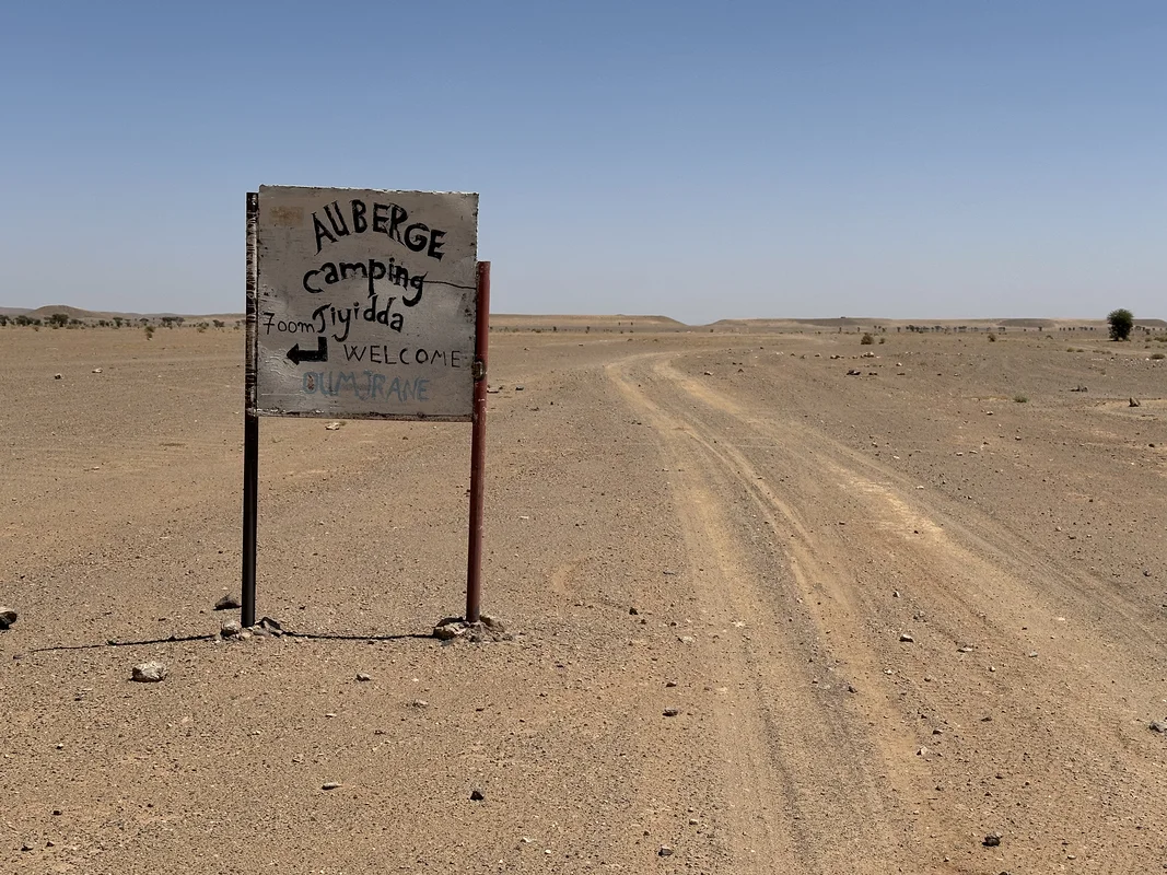
Alnif is the nearest town on the main road to Oumjrane, a traditional oasis village in the Anti-Atlas to the south, known for its palm oasis and the historic copper-mining area of Bou N'has. Reaching it is a detour off the main road, and a 4x4 or an experienced local driver makes the trip more comfortable. Read more on our Oumjrane page.
Rissani and the final stretch to Merzouga
The road leaves the mountains behind as it approaches the Tafilalet oasis. Rissani is the historic heart of the region, with the remains of medieval Sijilmassa, the mausoleum of Moulay Ali Cherif and a busy traditional souk on market days. Try madfouna, the stuffed flatbread the area is known for. From Rissani it is a short drive south to Merzouga and the towering dunes of Erg Chebbi.
Building the road into a loop
This road is the missing link in a classic southern loop. A good plan runs from Marrakech over the High Atlas to Ouarzazate, down the Draa Valley to Zagora (with an optional night in the dunes of Erg Chigaga beyond M'Hamid), east along this road to Merzouga, then back west via the Todra and Dadès gorges. Allow at least five or six days to enjoy it without rushing.
Experienced 4x4 operators also run off-road pistes between the Draa and the Tafilalet, closer to the Algerian border. These cross remote, unsigned terrain and should only be attempted with a reputable local guide and a suitable vehicle; the border itself is closed and must not be approached.