For many travellers, Fes is the smartest gateway to the Moroccan Sahara. The road to Merzouga is shorter than the approach from Marrakech and avoids the long switchbacks of the Tizi n'Tichka, yet it still crosses some of the country's most varied scenery.
In a single day you pass from the imperial city into the cedar forests of the Middle Atlas, over the high, open plateaus around Midelt, through the eastern High Atlas and down the long, palm-filled Ziz Valley to the Tafilalet oases and the dunes of Erg Chebbi. This guide covers the distance and driving time, the main stops, your transport options and how to fit the journey into a wider itinerary.
Key facts
- Distance
- Roughly 460–480 km depending on the exact route.
- Driving time
- Around 7 to 8 hours behind the wheel, longer with photo and meal stops.
- Main route
- Fes – Ifrane – Azrou – Midelt – Errachidia – Erfoud – Rissani – Merzouga.
- Highlights
- Middle Atlas cedar forest, the Ziz Gorges, the Ziz Valley palm groves and the Tafilalet oases.
- Ways to travel
- Private driver or organised tour, rental car, or long-distance coach.
- Winter note
- Snow occasionally affects the Middle Atlas around Ifrane, Azrou and Midelt; check conditions.
Distance and driving time
Fes to Merzouga is roughly 470 km, and the drive takes around seven to eight hours without long breaks. The roads are paved all the way and generally in good condition, but much of the first half is through mountains, where speeds are lower and you may meet trucks, roadworks and livestock.
Realistically, with stops for coffee, lunch and the viewpoints, the journey fills a full day. If you leave Fes early in the morning you can reach the edge of the dunes in the late afternoon, in time for a sunset camel ride into a desert camp. Arriving after dark is less pleasant, as the final stretches can be poorly lit and you miss the best light over the sand.
The route, stage by stage
The standard route heads south out of Fes and climbs steadily into the Middle Atlas:
- Ifrane: a tidy mountain town with Alpine-style architecture, often nicknamed the "Switzerland of Morocco." A good first coffee stop.
- Azrou and the cedar forest: the Atlas cedar woods around Azrou are home to Barbary macaques, which are often seen near the road. Please do not feed them; it harms their health and makes them aggressive.
- Midelt: a high-plateau town between the Middle and High Atlas, known for its apple orchards and a convenient place for lunch.
- The eastern High Atlas and the Ziz Gorges: after crossing the mountain pass south of Midelt, the road follows the Ziz river through a narrow canyon of folded rock.
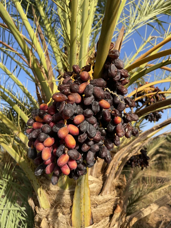
- Errachidia and the Ziz Valley: south of Errachidia, a ribbon of date palms and earthen ksour follows the river, one of the most photogenic stretches of the drive.
- Erfoud and Rissani: the market towns of the Tafilalet. Erfoud is known for fossils and dates; Rissani for its traditional souk and the ruins of Sijilmassa.
- Merzouga: the final run south brings the dunes of Erg Chebbi into view, rising abruptly from the flat stony plain.
Ways to travel: driver, tour, car or coach
There are three main ways to make the trip:
- Private driver or organised tour: the most common choice. A driver handles the long mountain roads, and most trips bundle the transfer with a camel ride and a night in a desert camp. Shared group tours are cheaper; private trips let you set the pace and the stops.
- Rental car: self-driving is very doable on paved roads and gives the most freedom. Drive defensively, avoid night driving, carry your licence and passport for routine police checkpoints, and fill up when you can in the larger towns.
- Long-distance coach: national coach companies run services towards Errachidia, Erfoud, Rissani and Merzouga. It is the cheapest option but slow, and some departures are overnight. Check current timetables locally, as schedules change.
Whichever you choose, compare reviews carefully and confirm exactly what is included before you book. For a broader comparison of trip styles, see our guide to Sahara desert tour itineraries.
Itineraries: one, two or three days
One day, one way: drive Fes to Merzouga, ride into camp at sunset and sleep in the dunes. Tiring, but it works if you are short on time.
Two days with an overnight stop: break the drive at Midelt or in the Ziz Valley, then continue in the morning with time to visit Rissani's souk or Erfoud before reaching the dunes. A gentler pace and better light for photography.
Three days, Fes to Marrakech via the desert: the most popular plan. Day one runs Fes to Merzouga with a night in camp; day two heads west through Tinghir and the Todra Gorge to the Dadès Valley; day three continues via Ouarzazate and Aït Benhaddou over the High Atlas to Marrakech. Travelling one way like this avoids repeating any road. The reverse direction is covered in our Marrakech to Merzouga guide.
Extending the trip south and west
With an extra day or two, Merzouga makes a good base for the wider southeast. The quieter route west from Rissani passes Alnif, Morocco's fossil capital, and continues towards Zagora and the Draa Valley (see our Zagora to Merzouga guide). Oumjrane, a small oasis village in the Anti-Atlas south of Alnif, rewards travellers looking for somewhere far from the tour-bus circuit.
When to go and seasonal tips
The most comfortable months are roughly October to April. In mid-winter, the Middle Atlas can be cold and occasionally snowy around Ifrane, Azrou and Midelt, so allow extra time and check road conditions; the desert itself has mild days and cold nights. Summer drives are hot, and Merzouga's daytime temperatures can be extreme. For a month-by-month view, read our guide to the best time to visit the Sahara, and see what to pack for the temperature swing.